By John Lilies & Lana Carbon
August 28th, 2019
Day 4: May 21st, 2019 – Sault Ste Marie to Marathon
[John] This was our morning to leave Sault Ste Marie and make our way up to Marathon for the night. We could have driven straight to Thunder Bay on this day but we didn't want to have a super long day in the car, so we decided to split the jaunt with a night of rest. Neither of us had ever been to Marathon, so we thought we would check it out and make it our overnight rest stop.
I actually really enjoyed our time in The Soo but I was also ready to move on. We had some great down time and exploration time while in The Soo, and we had nature time that helped me relax so, when it was time to go, I was ready to move forward and meet Day 4 of our trip.
We were so fortunate to have a rain-free day for this drive and what an incredibly beautiful day it was. We took our time getting ourselves together and after getting coffee and filling up ol' Lucy's gas tank, it was about 9:45am when we actually got on the Trans-Canada highway.
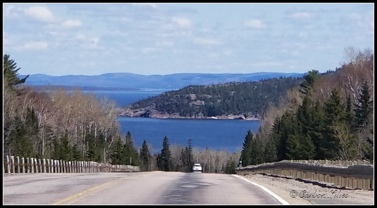
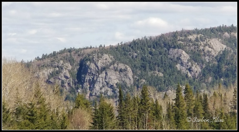
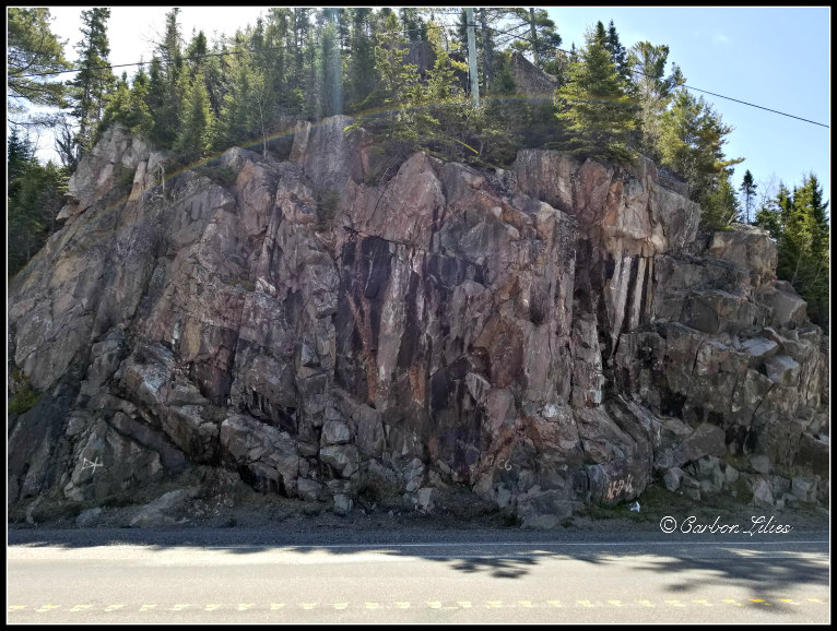
We took our time driving along, slowly making our way to Marathon. We love giving ourselves as much time as possible so we can check out different sights and places along the way; stopping when we want to and taking wee detours as we see fit. Until a bit north of Wawa, we noticed that there were still patches of snow and ice in the receded areas along the road. We saw a fair bit of that on the way to Sudbury but hadn't seen much in The Soo. It reminded us again, that May down in the city holds a very different season than up north.
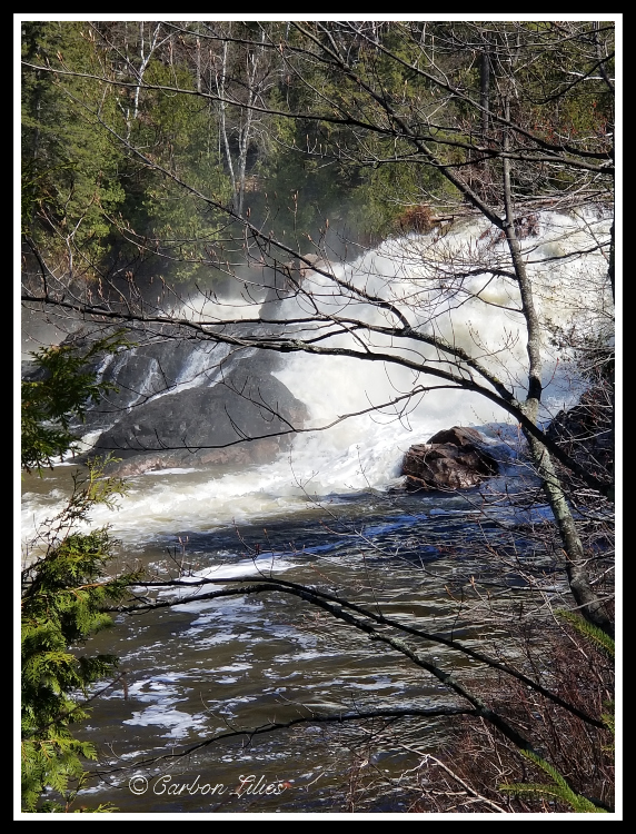
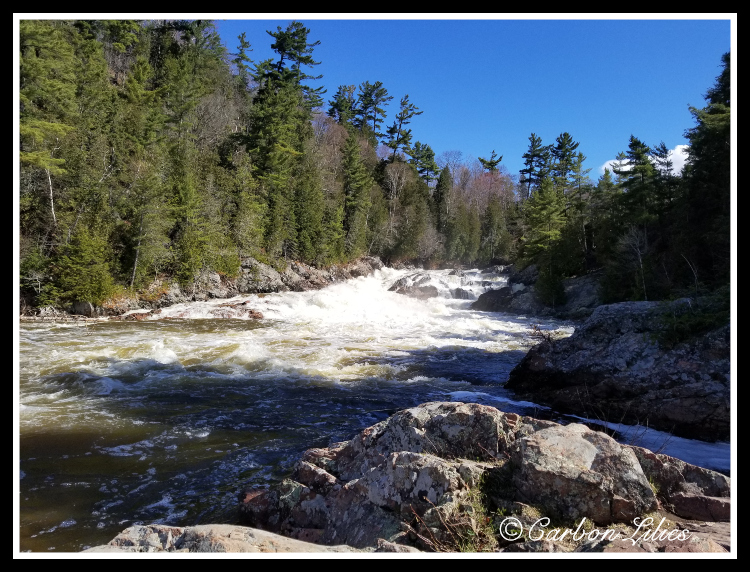
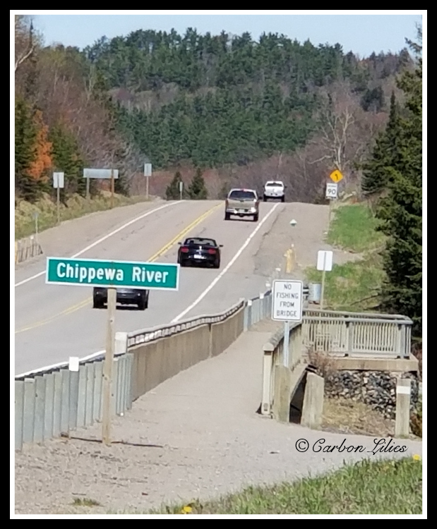
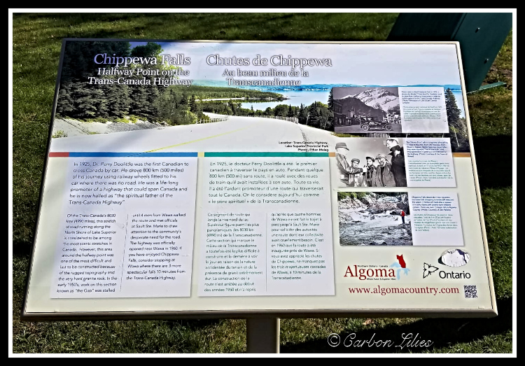
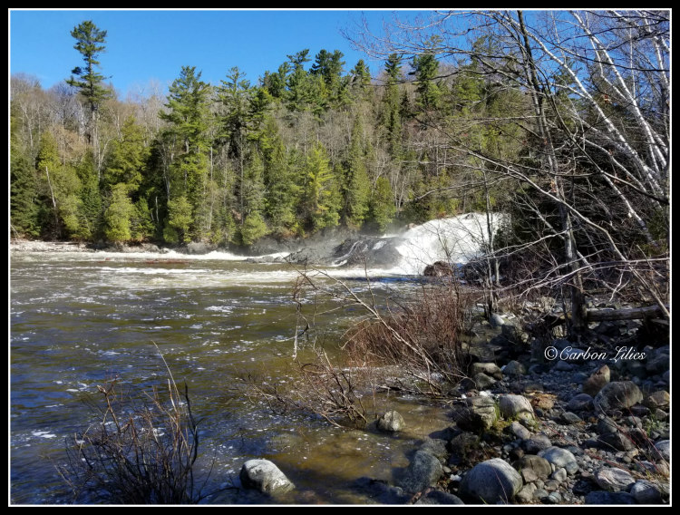
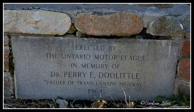
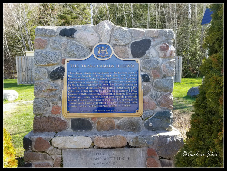
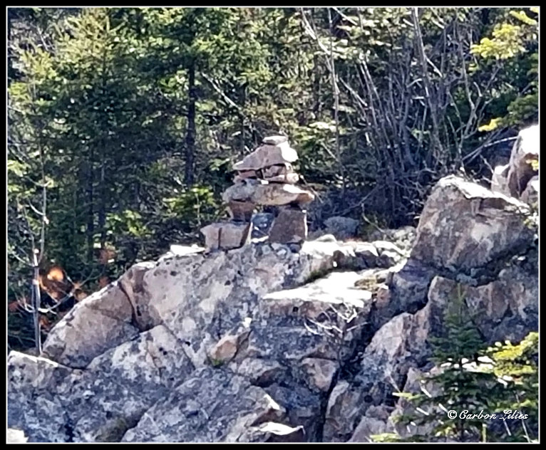
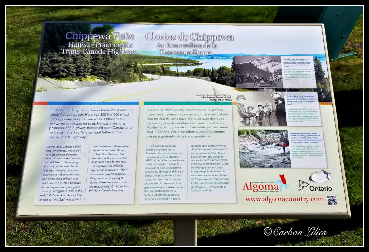
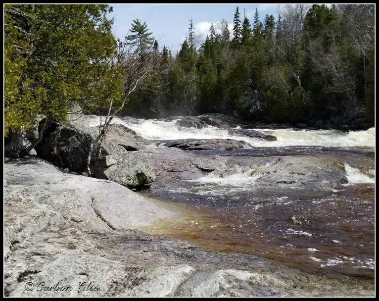
A little ways out of Sault Ste Marie, we passed a beautiful, small water fall/rapids and as Lana exclaimed sheer joy at the sight of it ([Lana] FALLS! FALLS! LOOK AT THE FALLS!), I turned us around ([Lana] YIPPPPEEEE!!!!) and pulled into the little parking lot clearly designed for those of us who want to safely enjoy the view. Where Chippewa River/Falls crosses the Trans-Canada highway, is the approximate halfway point between Victoria, British Columbia and Saint John's, Newfoundland. You can find a plaque marking the point, benches at the side of the highway so you can comfortably sit to enjoy the beauty of the falls, as well as a path to climb up alongside the falls a bit, when the water level allows like it did on this day. (The point to where one can climb is not actually the top of the falls but it is the 'top' that people can feasibly reach on the path, relatively safely.)
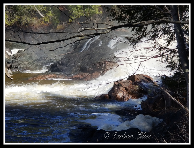
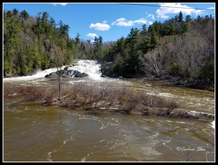
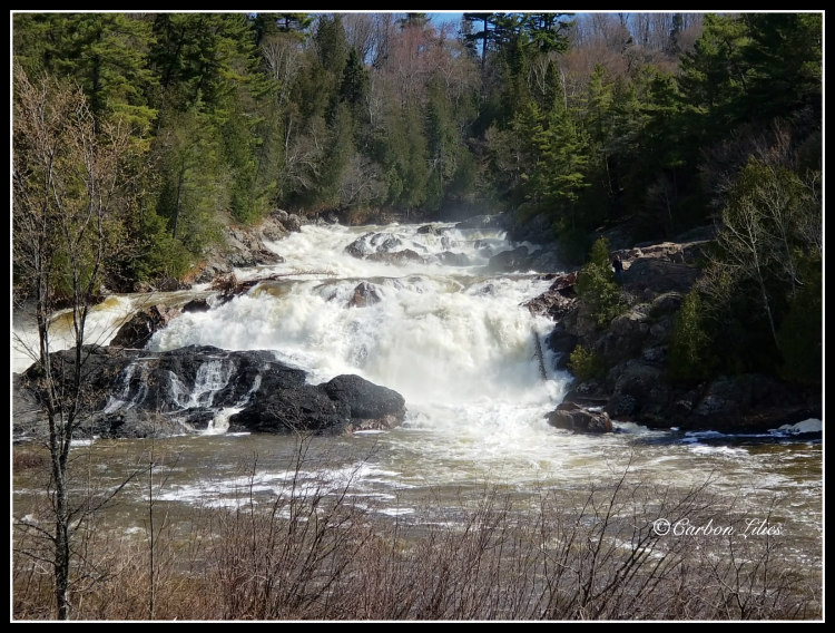
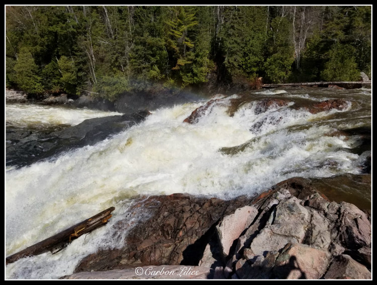
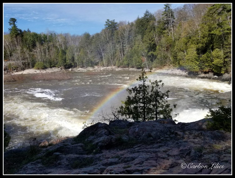
[John] We actually did climb up the path a little bit and took some pictures and video. It was absolutely magnificent. Honestly though, it was also one of those moments when I consciously thought, "Okay John, keep your wits about you because this is the moment when the tourist innocently climbs a precarious path in the wrong footwear so she can take the photo, then suddenly slips or outright falls and dies, becoming an embarrassing headline warning for all the other tourists in the wrong footwear who are looking for the photo opportunity. Don't be that girl!" It actually made me think about the warning signs along the Great Ocean Road in Victoria, Australia, when taking in the different views along the coast. There, they have signs showing an illustrated person falling (about to go off a cliff), and the sign plainly says "You may fall and DIE...". That's what was really going through my mind in this moment and it maybe made me chuckle a bit. We weren't on a cliff edge by any means, but it would have taken nothing for either of us to make a wrong step and go down. We so easily could have become those people at whom we shake our heads when we read the news.
[Lana] The worst part is that we had even planned for this type of scenario to arise when we were packing for the trip. We had multiple types of footwear with us in the car but we simply didn’t bother to take the time to change. Not only would we have been those headlines we shake our heads at but it also would have been our own fault because it would indeed have been totally preventable.
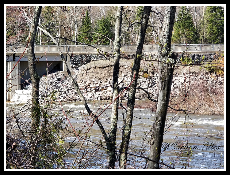
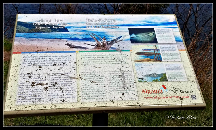
[John] After safely reaching the top and safely descending and enjoying the view from the benches set up on the side of the highway, and sadly noting the garbage people have carelessly tossed into the water below the lookout, we continued on and drove until we saw another rest area, this one at Alona Bay.
These little roadside stops are so important to us when we go for drives, whether long or short. This is where we learn a lot about our history that brings the knowledge to life, even if we had already learned about it in a book. We previously had no idea that Chippewa River, where it crosses the Trans-Canada highway, could possibly be halfway between Victoria and St. John's. It still doesn't seem conceivable to me; that it's as far east as Ontario and that there is still so much distance from that point in Ontario to the east coast of Newfoundland.
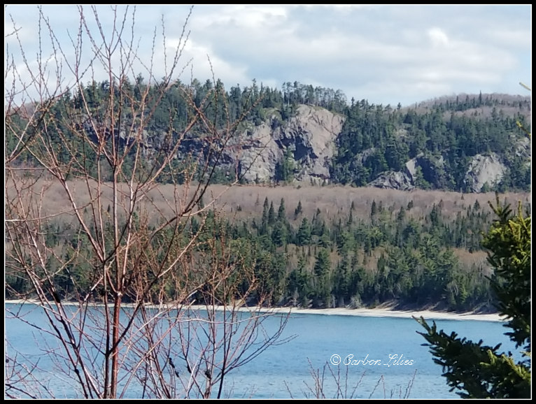
And here, at Alona Bay, we discovered we were standing only 30 kilometres east of where the Edmund Fitzgerald sank. I didn't realize we would be that close to the site while on our trip. Also, when looking out to the water, there is a point to the right (slightly north-ish) where it is believed uranium was first discovered in Canada. I love learning these things while being right there in the area. If my schooldays had presented history in such a vivid and relatable way, I may have actually learned and retained something.
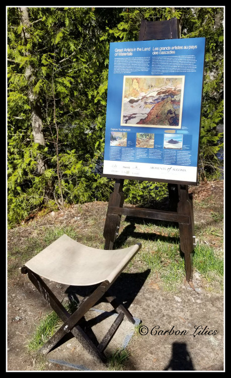
[Lana] There are times when I will see something that I want to take a picture of and John will pull over for me so that I might get out to get a better angle or not have to rush my shot. I have learned to always take a photo of any accompanying plaques that may give any significant historical information for John to peruse as well. She is turning into quite the history buff.
[John] I really appreciate that, actually. Being behind the driver’s seat means that I can’t always take in the signs and plaques that accompany the sites. I love that Lana captures these for me.
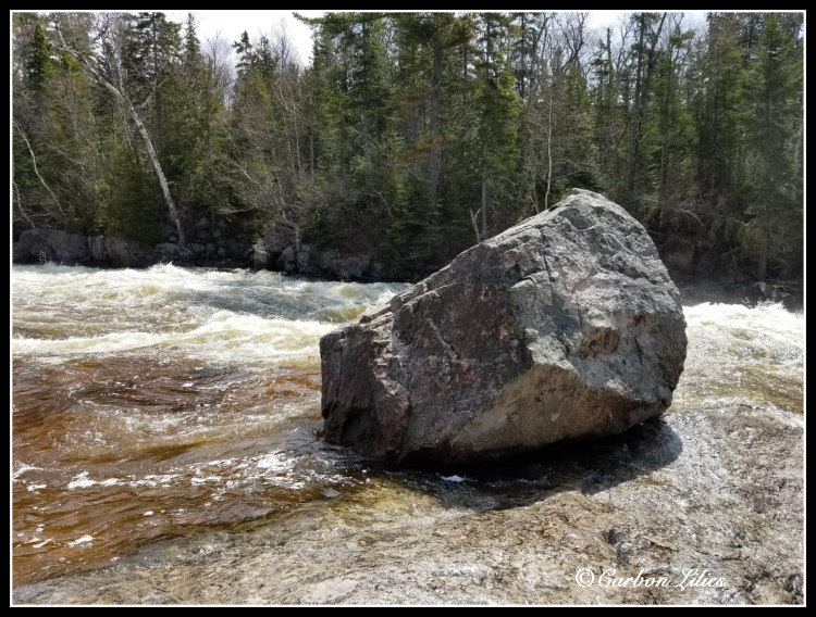
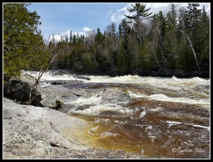
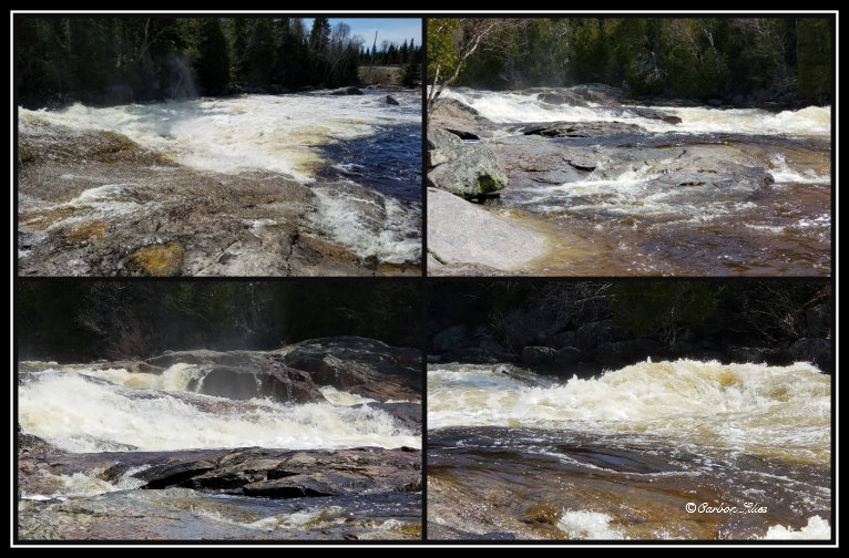
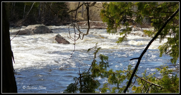
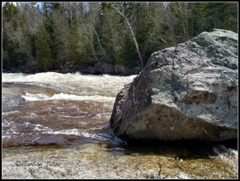
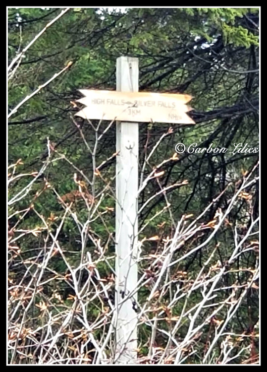
Pinguisibi (Sand River Falls) was an actual planned stop I had found while looking at the map and studying the route to see what we might find along our way. This was another beautiful spot of rapids/falls and while we were out on the rocks enjoying the view, a man and his dog showed up and the gentleman asked us to take a photo of them on his phone. He was from Thunder Bay and was heading south; he was quite kind and friendly and we all chatted a bit about just how magnificent the views were along the drive, including the snow and ice patches we were still seeing.
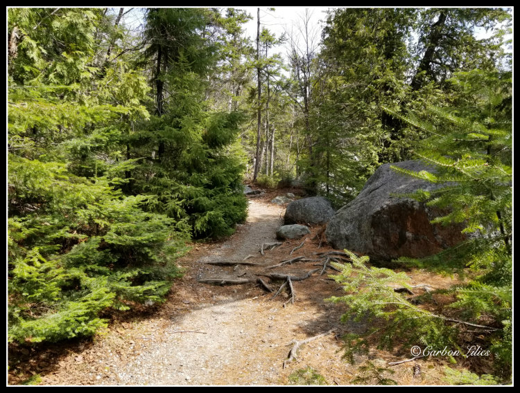
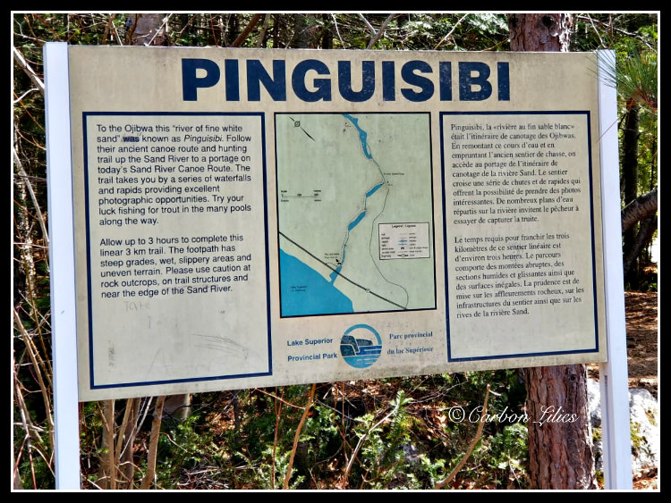

[John] Pinguisibi has a trail within the park but we didn't venture up to explore it, as we did still have a while to go on our drive. The area likely makes for a great hiking and picnicking experience.
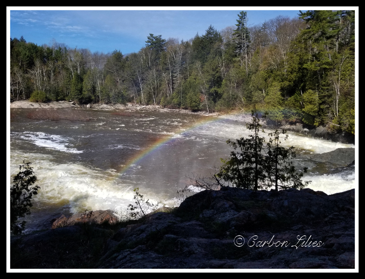
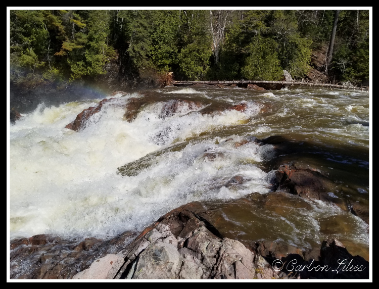
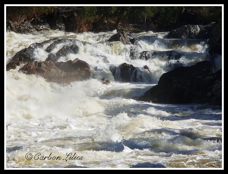
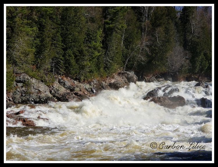
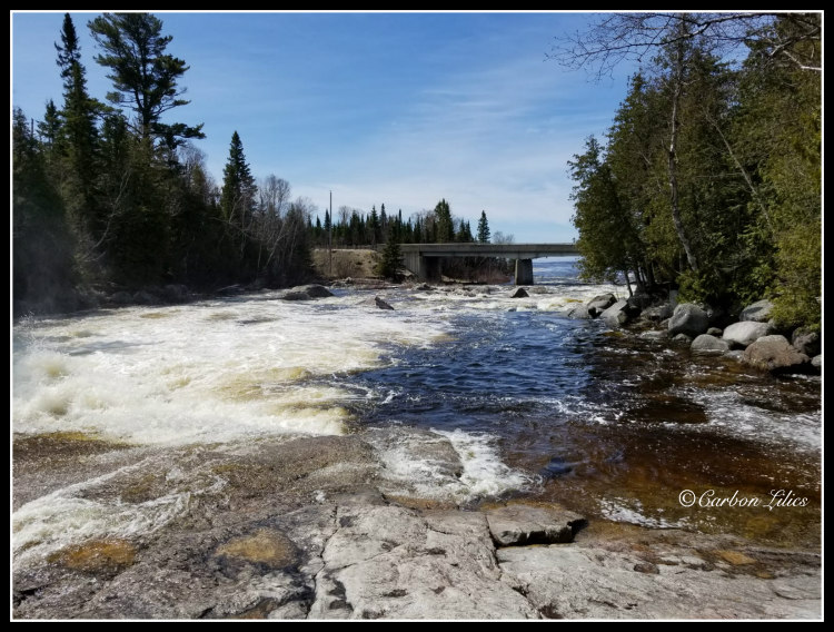
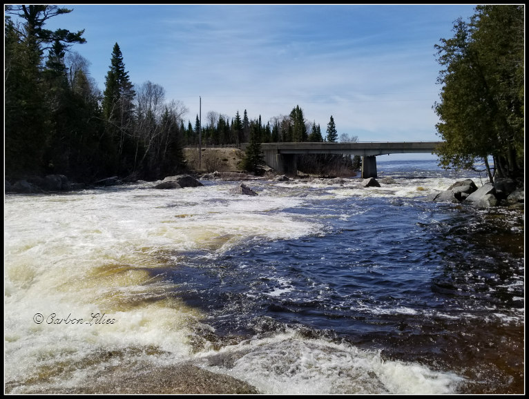
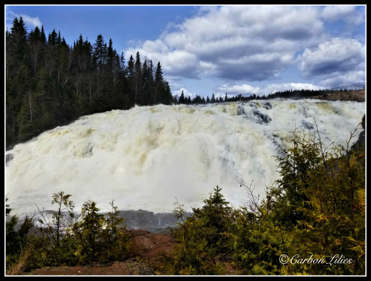
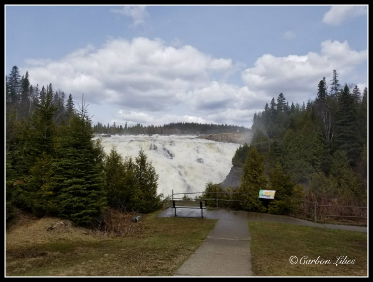
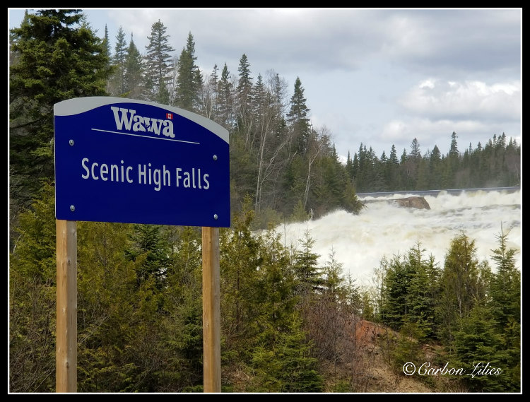
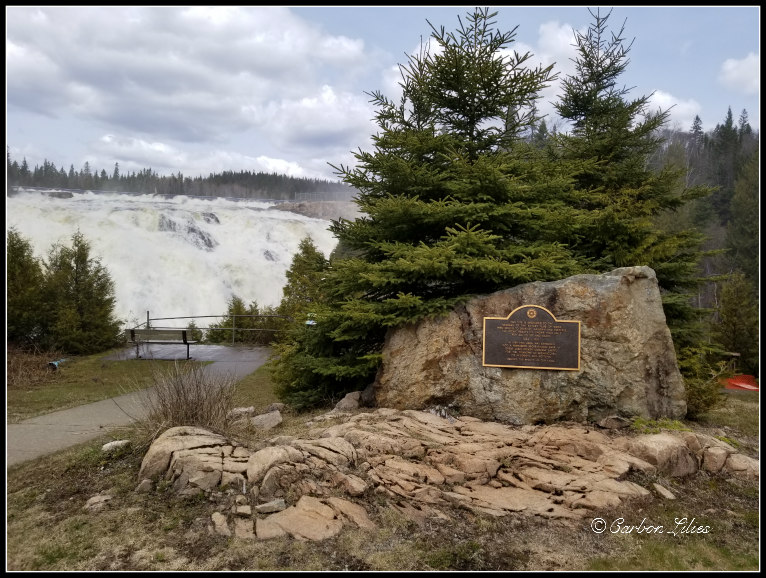
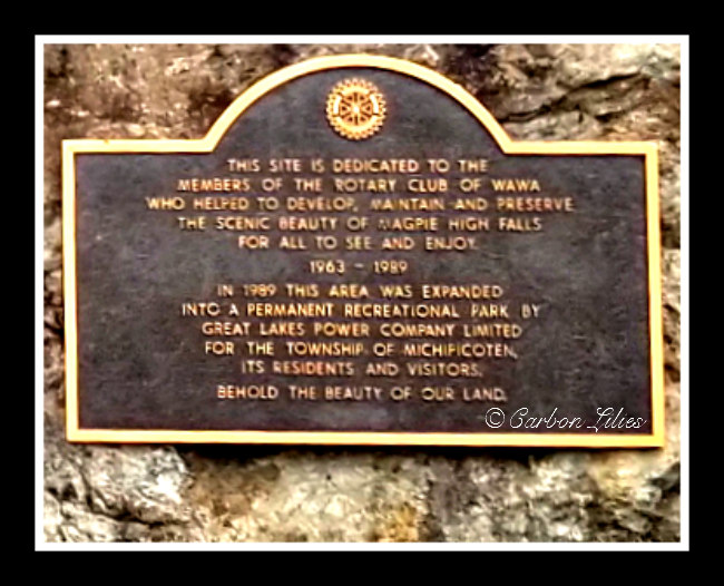
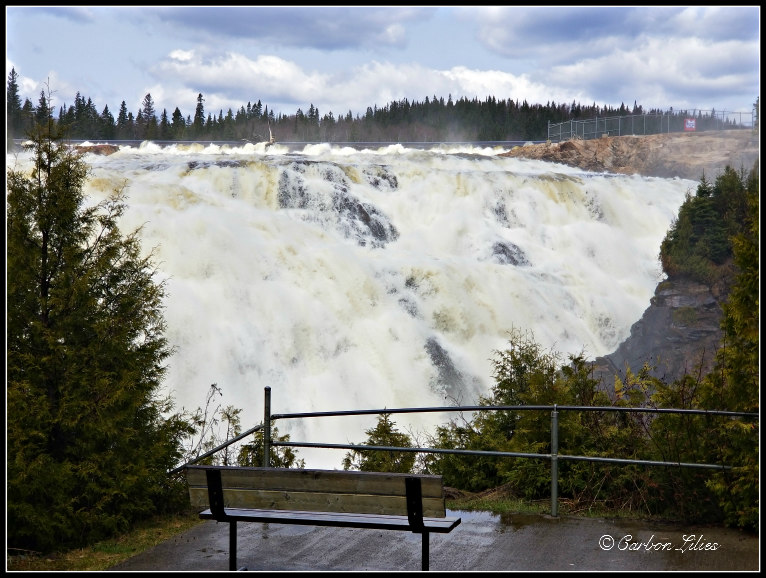
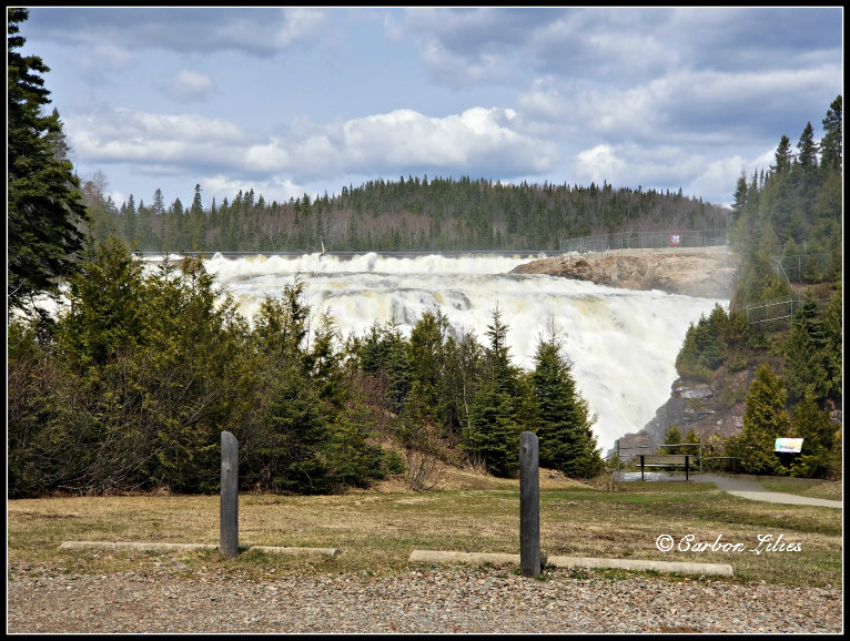
Our next stop was also planned: Magpie High Falls. We again found this one while exploring the map route to see what might be interesting along the way, and we decided we should plan to stop and check it out. While driving along the back road to find the falls, we almost decided to quit as the road was a bit nerve-wracking (thick gravel turned to thick wet mud while a massive road construction grader was also flattening out the way). But thankfully, we pushed on for the incredible beauty of it. It was powerful and the water spray was quite strong. So worth the drive in. Though Lucy is not an off-road vehicle she does a lot of off-road driving and she tends to excel at it. We were so grateful that she glided through the mess and allowed us the opportunity to take in this experience with Magpie High Falls. It was impossible to not simply stand in front of the falls, being soaked from the spray, and deeply inhale completely relaxing fresh air and perspective.
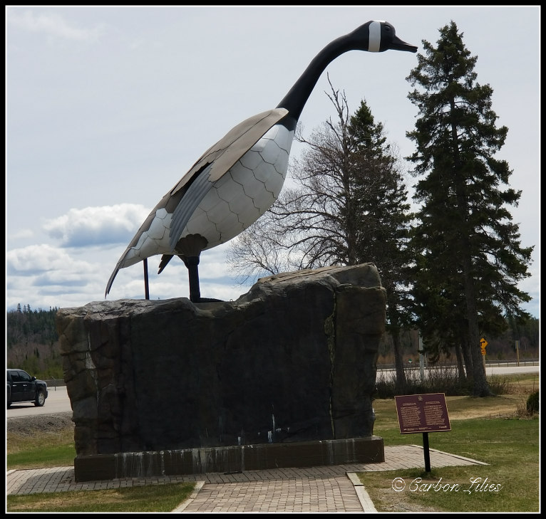
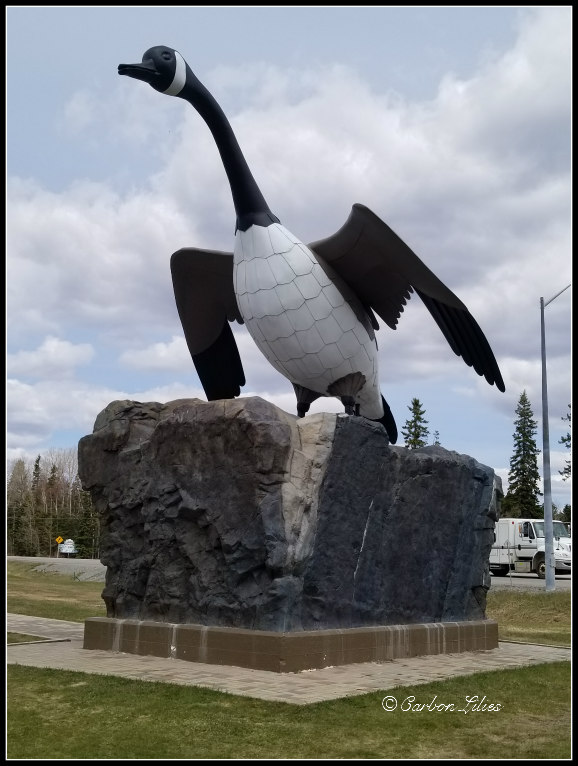
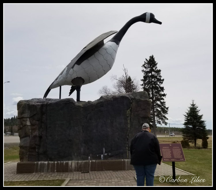
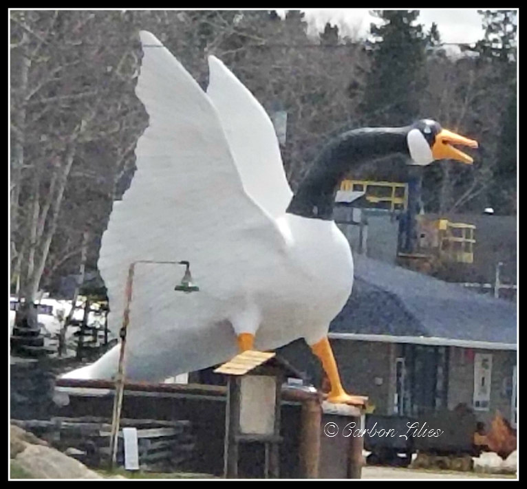
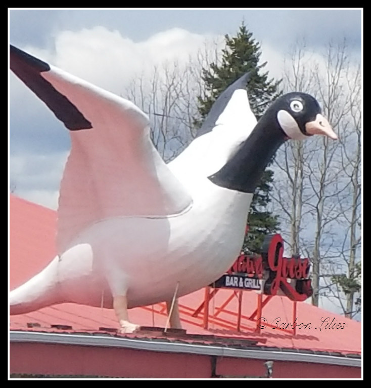
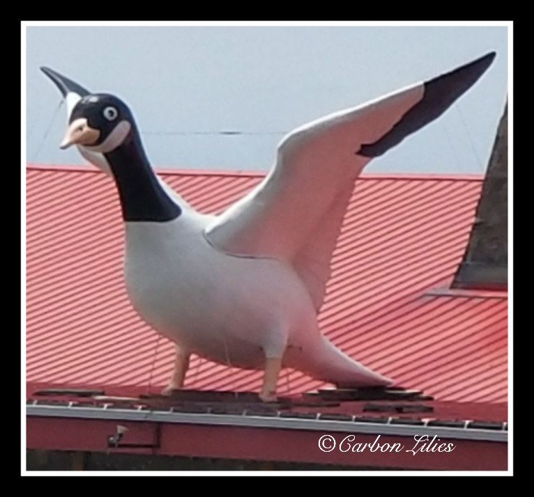
[John] Immediately following Magpie was Wawa, home of the infamous goose. Stopping to see the goose is almost a requirement when passing through here, no matter how many times you may have already seen it. We grabbed a quick little lunch at Subway and stopped at the information centre to sit at a picnic table to eat. In typical Carbon Lilies style, the information centre itself was closed due to plumbing/water issues and so we just walked around the grounds a bit after eating, and then we continued on with our journey.

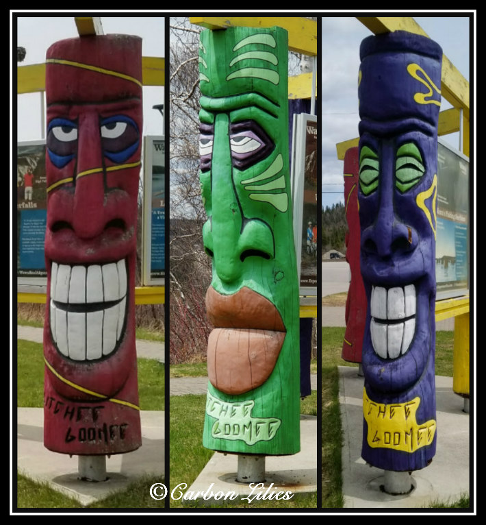
Here we are trying to fit in with our surroundings.
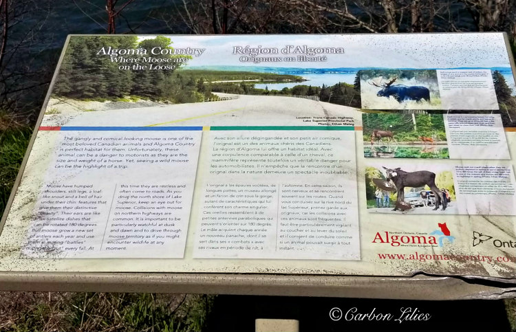
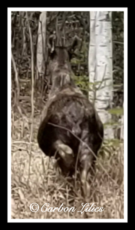
[John] Not far north of Wawa, we spotted moose #3 on Lana's side of the road, with its head bent down in the ditch drinking water. It wasn't right at the road-side but it was still close. It had really black, rough hair on its back and as we came alongside it, it looked at us and took off into the woods (thankfully not out into the road). Lana managed to quickly capture a shot of moose bum, before it completely disappeared in the trees.
[John] A little while later, we made a quick stop at Depew River for a stretch. Here, there was a calm river and we saw a beaver-chewed tree that would soon need to be taken down safely if the beavers didn't finish it off first.
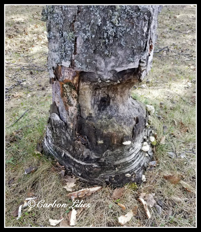
[Lana] Beavers can be nasty critters. I remember how angry Pa Carbon was one morning when he went out to find his beloved apple tree had fallen victim to some furry little dam-builders, and had been pulled to the shore of the river in our backyard. No more apples from that tree for him.
[John] But oh how cute wee bittle leavers are!
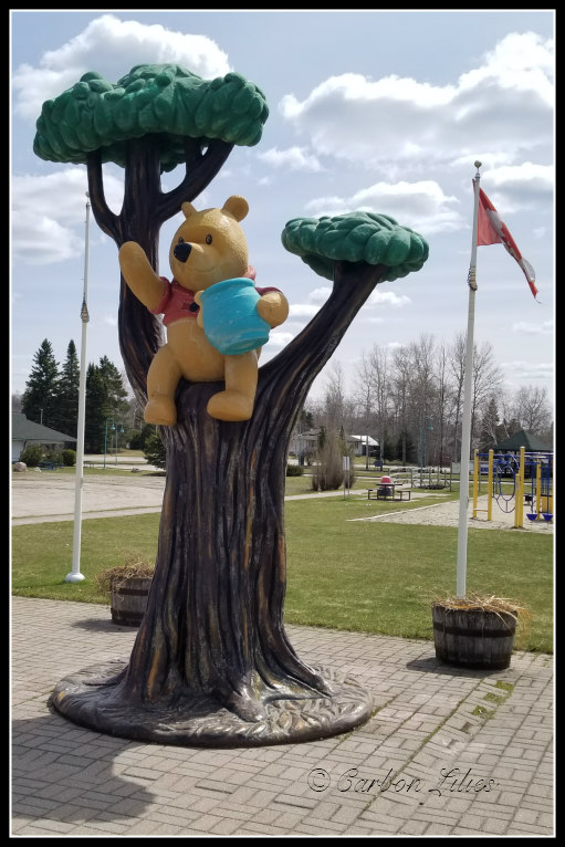
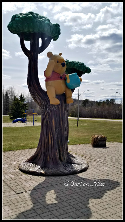
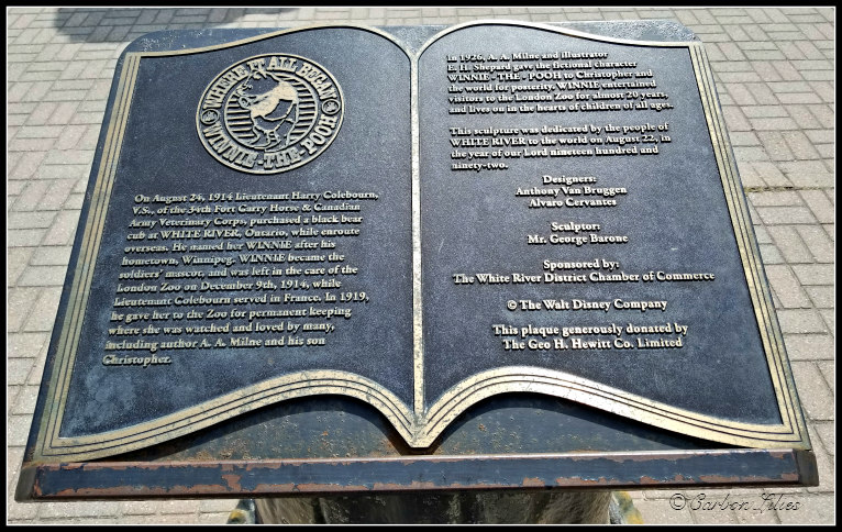
Next, we stopped at White River to find the statue of Winnie-the-Pooh. Of course, the information centre was closed but Lana still got up close to the outdoor monument for photos. As the story goes, a trapper found an orphaned black bear cub and sold it to a man travelling through Canada, Harry Colebourn. Mr. Colebourn was on his way to England and named the bear cub Winnie, for Winnipeg, Manitoba which was Colebourn's hometown. Winnie accompanied Mr. Colebourn to England but landed in the London Zoo when Colebourn had to move on to France. Eventually, one of the zoo visitors to fall in love with Winnie was Christopher Robin Milne and the rest, as they say, is history.
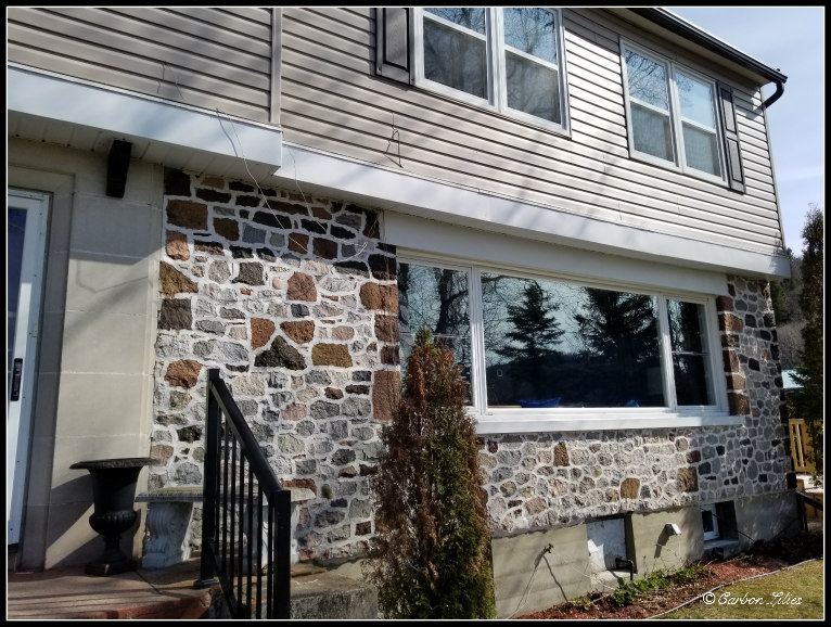
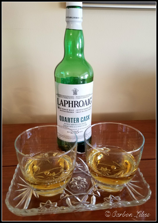
[John] Not long after White River and having enjoyed a lovely day on the road, we pulled into Marathon and found the wonderful Bed and Breakfast we had booked - Lakeview Manor. There aren't many accommodation options in Marathon and we were so happy we'd found vacancy at this house. It was a beautiful spot with a spectacular view and complimentary bourbon and wine. The management was friendly and welcoming and we couldn't have been more thrilled with our room.
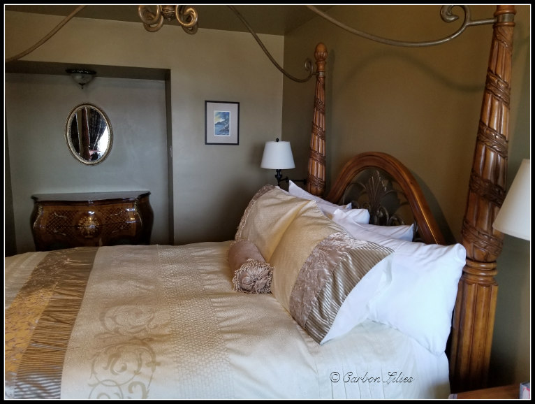
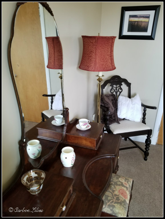
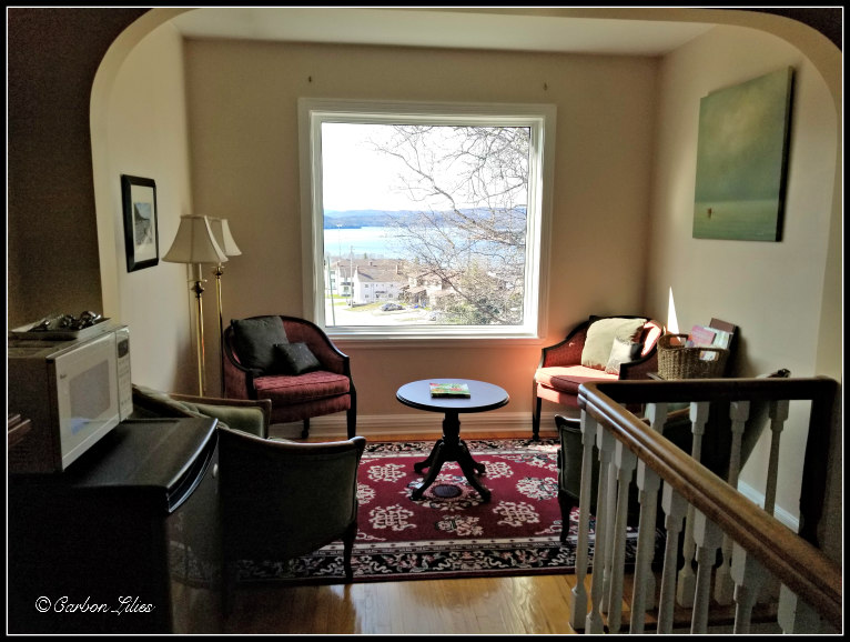
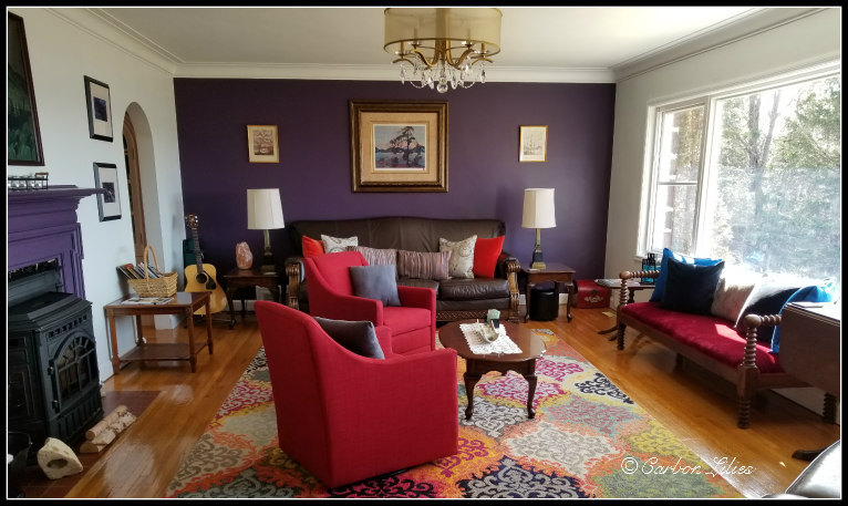
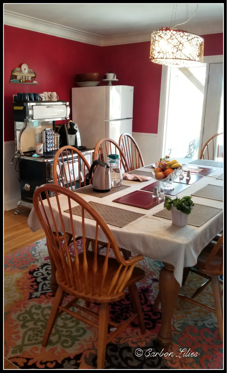
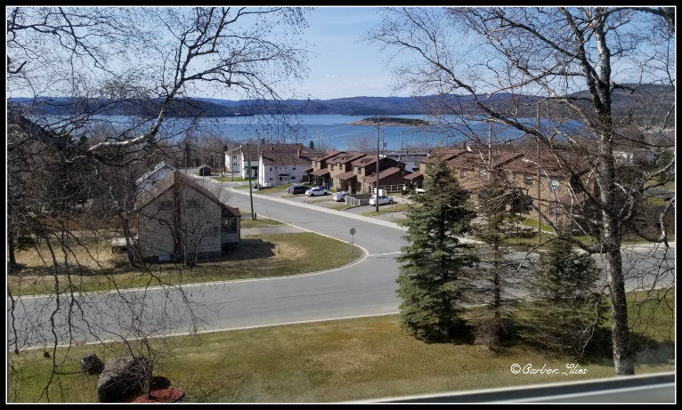
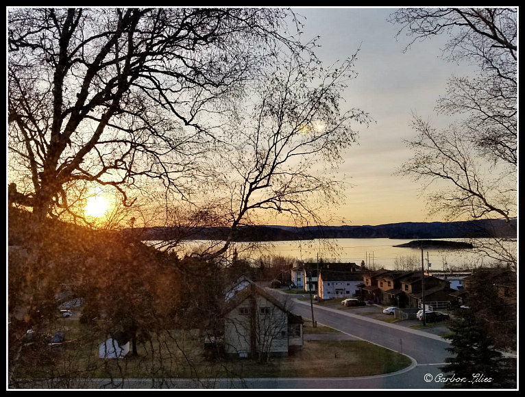
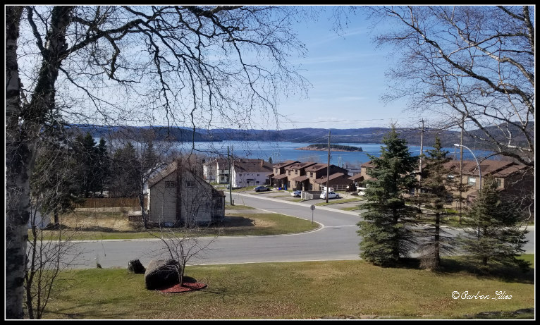
[Lana] We always get a little worried when it comes to B&B’s after some of our previous experiences being hit or miss, but after getting the tour of this beautiful place, all our worries were alleviated. While it was more than welcoming here, it was inclusive while still respectful of allowing you to maintain your privacy. The view was breathtaking, especially at sunset. The décor was absolutely amazing as well, with unique antique pieces. I think it is safe to say it turned into the best B&B experience we have ever had.
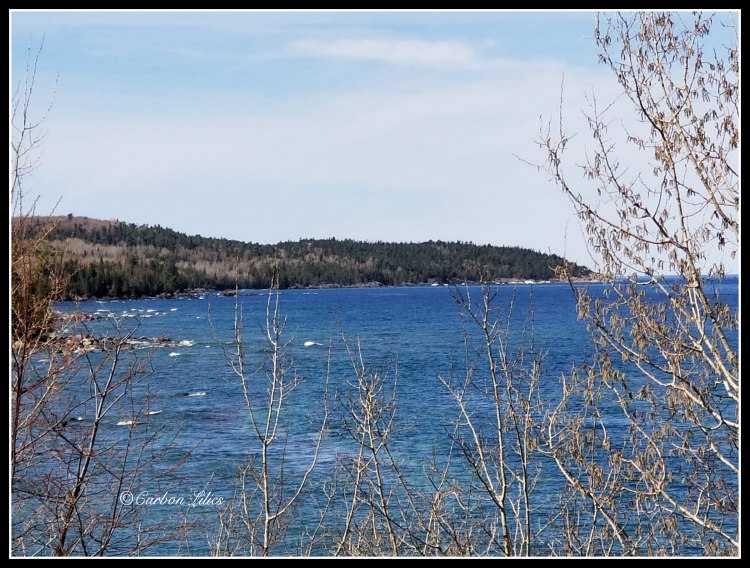
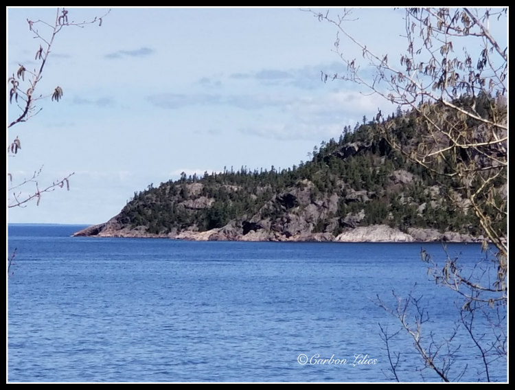
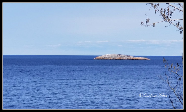
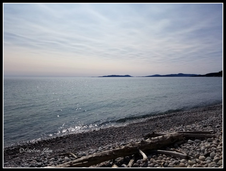
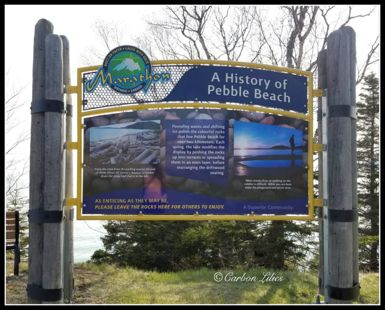
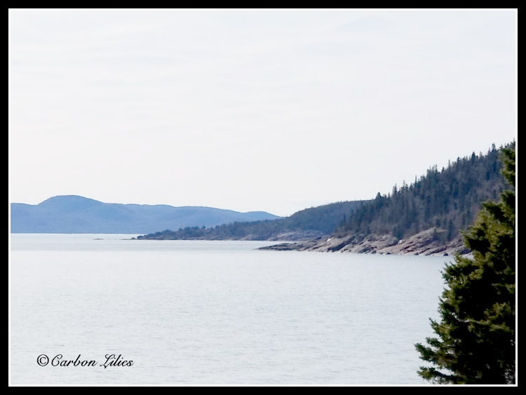
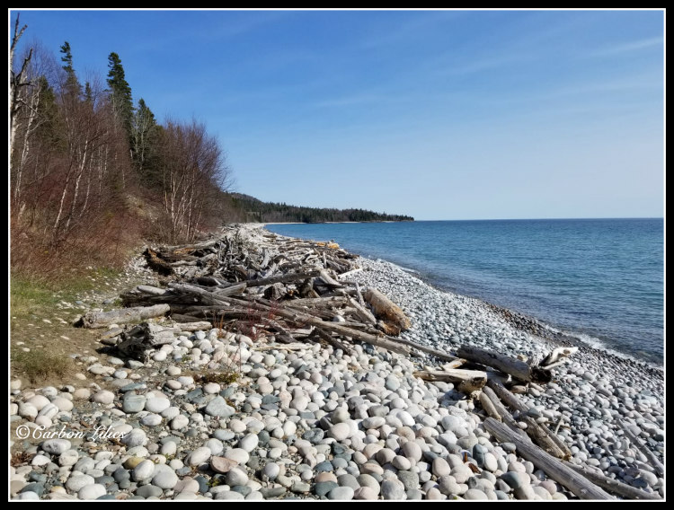
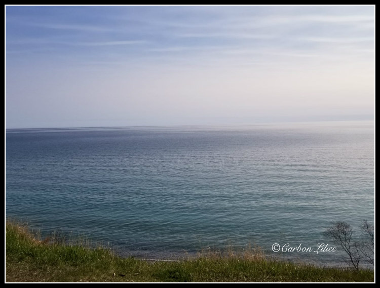
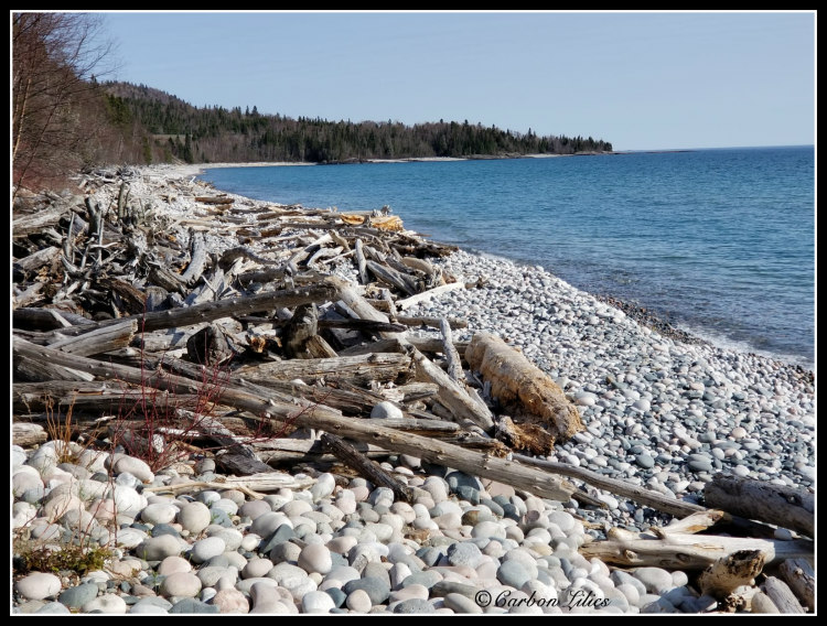
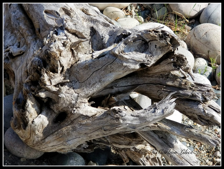
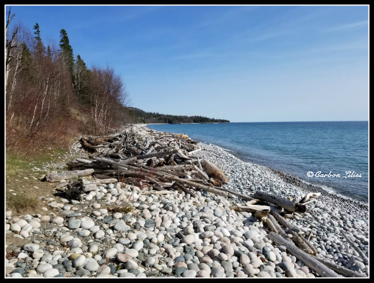
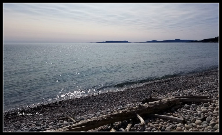
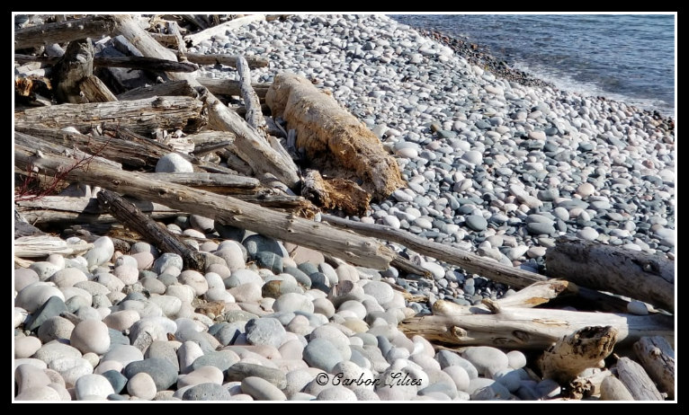
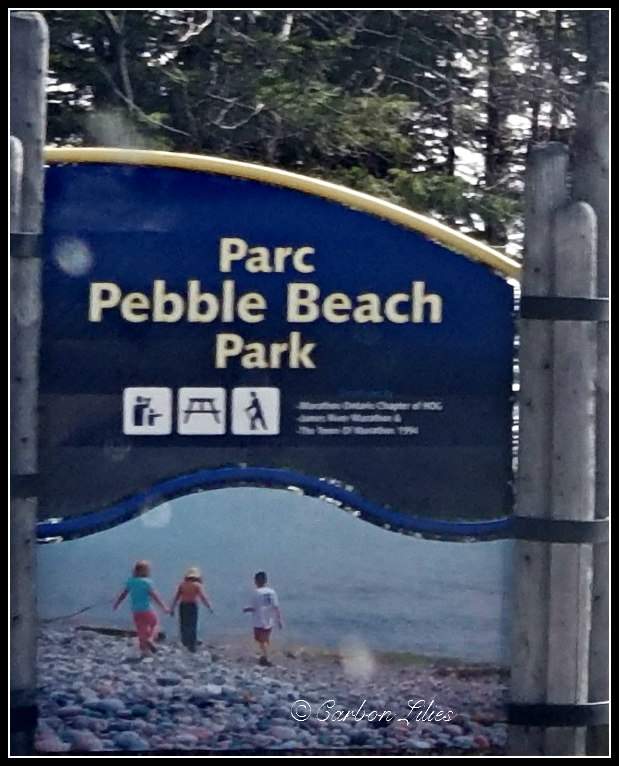
[John] Upon arriving, we unpacked the car, quickly freshened up, and went down to Pebble Beach for a little walk and an incredible view of Lake Superior.
[Lana] For all of you golf fans out there, no, not that Pebble Beach.
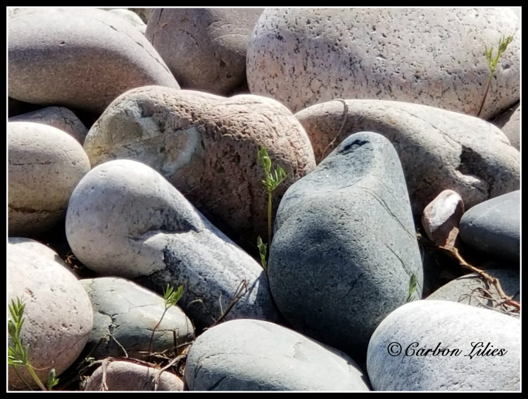
[John] The shore is entirely made up of beach rock and pebble, and driftwood. The area is so shaped by the rock that there are signs specifically asking visitors to leave the rocks behind and not take any souvenirs. We could understand why people would want to carry away some beach samples, as these rocks are stunning - so smooth and unique. But we behaved ourselves and left the rocks behind when we went back to our room for the night. Arriving back at our room for a good rest, a quick look at the odometer showed us we had, thus far, travelled 1,143.3 kilometres since leaving home. Gosh, we've previously done 1,000 in 24 hours!
[John] As we prepared ourselves for a good night of sleep, we hoped we might glimpse some Aurora Borealis but alas, our luck did not extend that far. Between our exhaustion levels knocking us out relatively early (honest - the one sip of bourbon had nothing at all to do with it, really) and the skies clouding over as the hours grew later, we decided to just close the curtains and focus on rest for the night.
[Lana] I tried to keep her awake… honest I did. It has been a longtime goal to see the Northern Lights and it wouldn’t be the same seeing them without her now (sometimes I curse the alcohol even as I watch it enter her system, just knowing the affects that it will have in only a few moments… it’s a good thing she hardly drinks at all).
[John] Day 5 will find us on our way to Thunder Bay, so please come back and join us for that stretch! Thanks for coming along with us and let us know if you’ve ever had the privilege of capturing a photo of moose bum, too! Happy misadventuring!
